Lista de cidades da Virgínia Ocidental
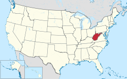
Estado da Virgínia Ocidental destacado em vermelho no mapa dos Estados Unidos.

Virgínia Ocidental divida pelos seus 55 condados.
A Virgínia Ocidental é um estado localizado no sul dos Estados Unidos. De acordo com o Censo dos Estados Unidos (2010), a Virginia Ocidental é o 37º estado por população, possuindo cerca de 1.852.994 residentes,[1] no entanto é o 10º menor estado por extensão territorial abrangendo cerca de 62.755 km².[2]
Abaixo segue-se uma lista das cidades da Virginia Ocidental.
A |
- Albright
- Alderson
- Anawalt
- Anmoore
- Ansted
- Athens
- Auburn
B |
- Barrackville
- Beckley
- Belington
- Belmont
- Benwood
- Bluefield
- Bramwell
- Bridgeport
- Bruceton Mills
- Buckhannon
C |
- Camden-on-Gauley
- Cameron
- Capon Bridge
- Carpendale
- Ceredo
- Chapmanville
- Charles Town
- Charleston
- Chester
- Clarksburg
- Clendenin
- Corporation of Ranson
- Cowen
D |
- Delbarton
- Dunbar
- Durbin
E |
- East Bank
- Eleanor
- Elk Garden
- Elkins
Excelsoir, McDowell County
Excelsoir, Upshur County
Excelsoir, Webster County
F |
- Fairmont
- Falling Spring
- Follansbee
- Fort Gay
G |
- Gary
- Gassaway
- Gauley Bridge
- Glen Dale
- Grafton
- Grant Town
H |
- Handley
- Harman
- Hinton
- Huntington
- Hurricane
- Huttonsville
I |
- Iaeger
J |
- Jane Lew
K |
- Kenova
- Keyser
- Keystone
- Kingwood
L |
- Lewisburg
- Logan
- Lumberport
M |
- Madison
- Mannington
- Marmet
- Martinsburg
- McMechen
- Montgomery
- Morgantown
- Moundsville
- Mount Hope
- Mullens
N |
- New Cumberland
- New Martinsville
- Nitro
O |
- Oak Hill
P |
- Paden City
- Parkersburg
- Parsons
- Pennsboro
- Petersburg
- Philippi
- Pleasant Valley
- Point Pleasant
- Princeton
R |
- Ravenswood
- Richwood
- Ripley
- Romney
- Ronceverte
S |
- Salem
- Shinnston
- Sistersville
- Smithers
- South Charleston
- Spencer
- St. Albans
- St. Marys
- Stonewood
T |
- Thomas
V |
- Vienna
W |
- War
- Weirton
- Welch
- Wellsburg
- Weston
- Westover
- Wheeling
- White Sulphur Springs
- Williamson
Williamstown
Referências
↑ «Resident Population Data - 2010 Census» (em inglês). United States Census Bureau. Consultado em 21 de dezembro de 2010
↑ «Appendix A. - Census 2000 Geographic Terms and Concepts» (PDF) (em inglês). United States Census Bureau. Consultado em 4 de setembro de 2011


